
The main mediums are video as I ride my motorcycle and show you the scenic beauty of Washington State (and maybe some others .) but also photos and route maps as well so members can find inspiration and explore new areas.
And because this is a community, I want members to share your favorite topics and photos with me and others as well.
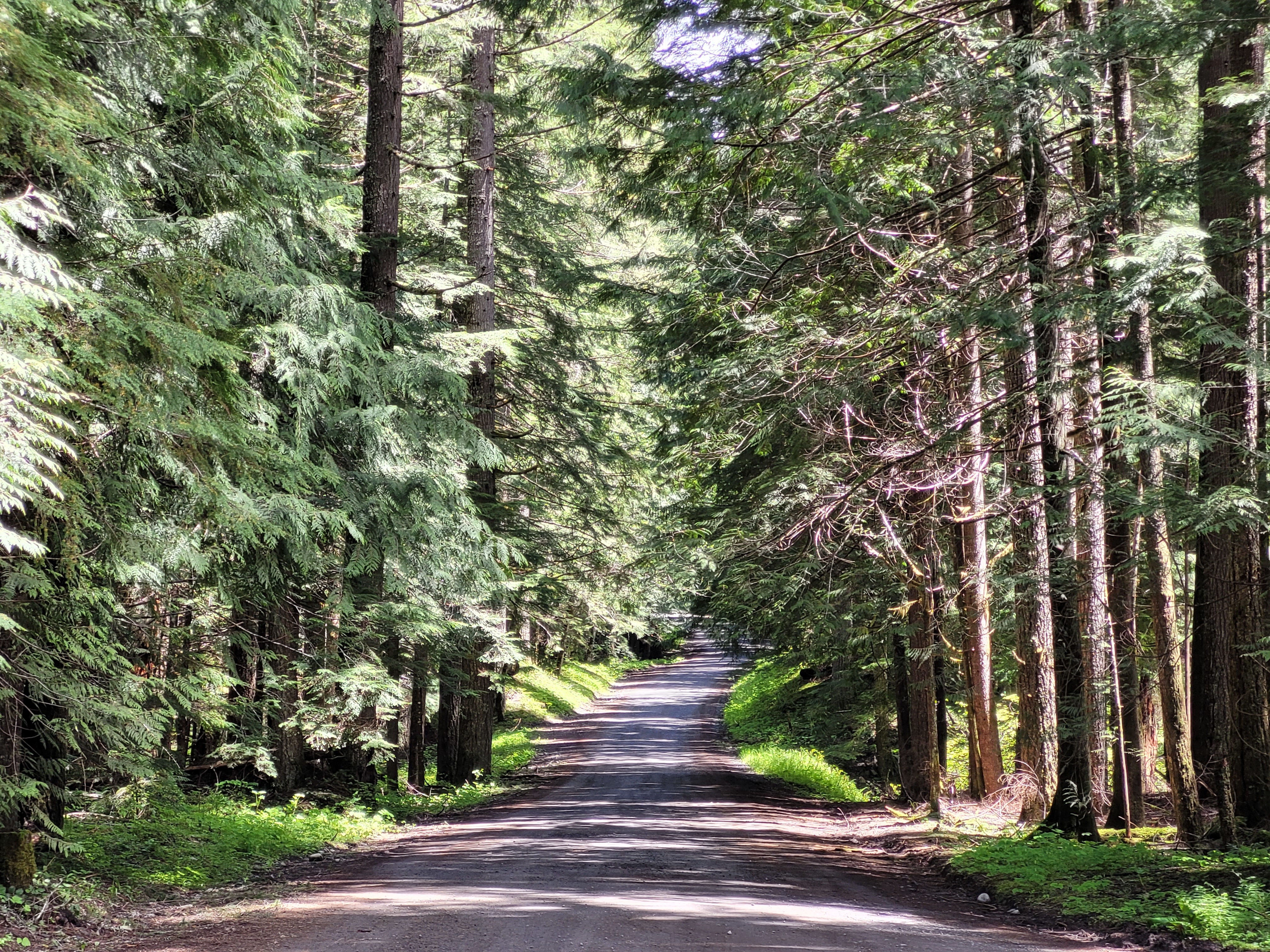
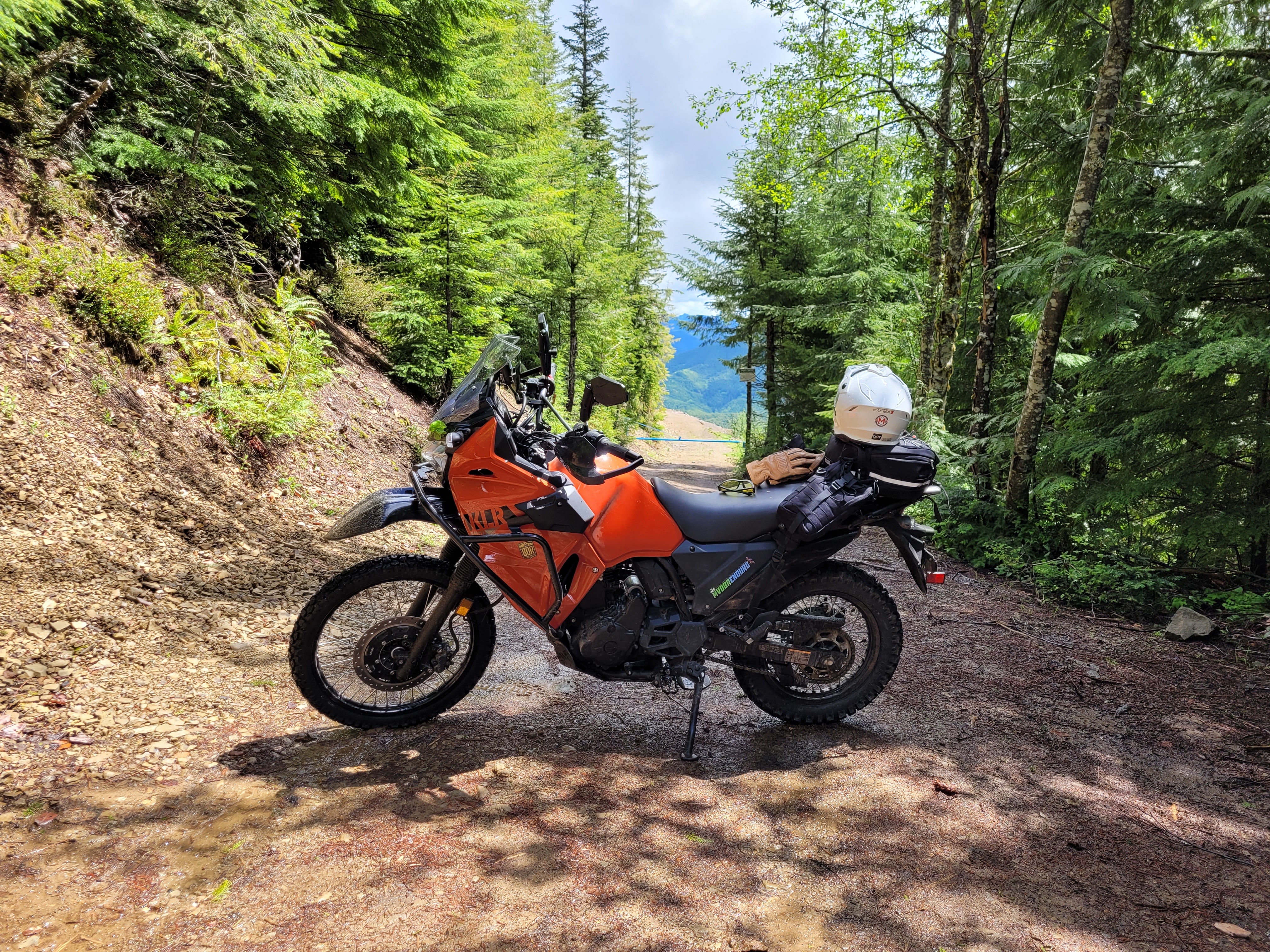
Decided my first ride on the new tires should be local familiar dirt so I headed to Forest Road 74 south of Elbe and then over to Skate Creek for FR 5230 to see what condition they were in. 74 is "more" open than it was so I had some fun exploring a bit. Lots of the ground is soft and slippery even when covered in gravel. My guess is saturated with water. Being solo, I endeavored to choose wisely in a couple spots, but for sure want to return once the rainy season is well behind us.
Over at Skate Creek I was once again convinced the beginning climb is probably my favorite bit of dirt so far. It's rocky, rutted, has some embedded rocks to avoid and at times its just a small stream.
I worked past the first two small snow patches only to finally get thwarted.
The ride was a patchwork, but it was good to get out.
Videos to come.
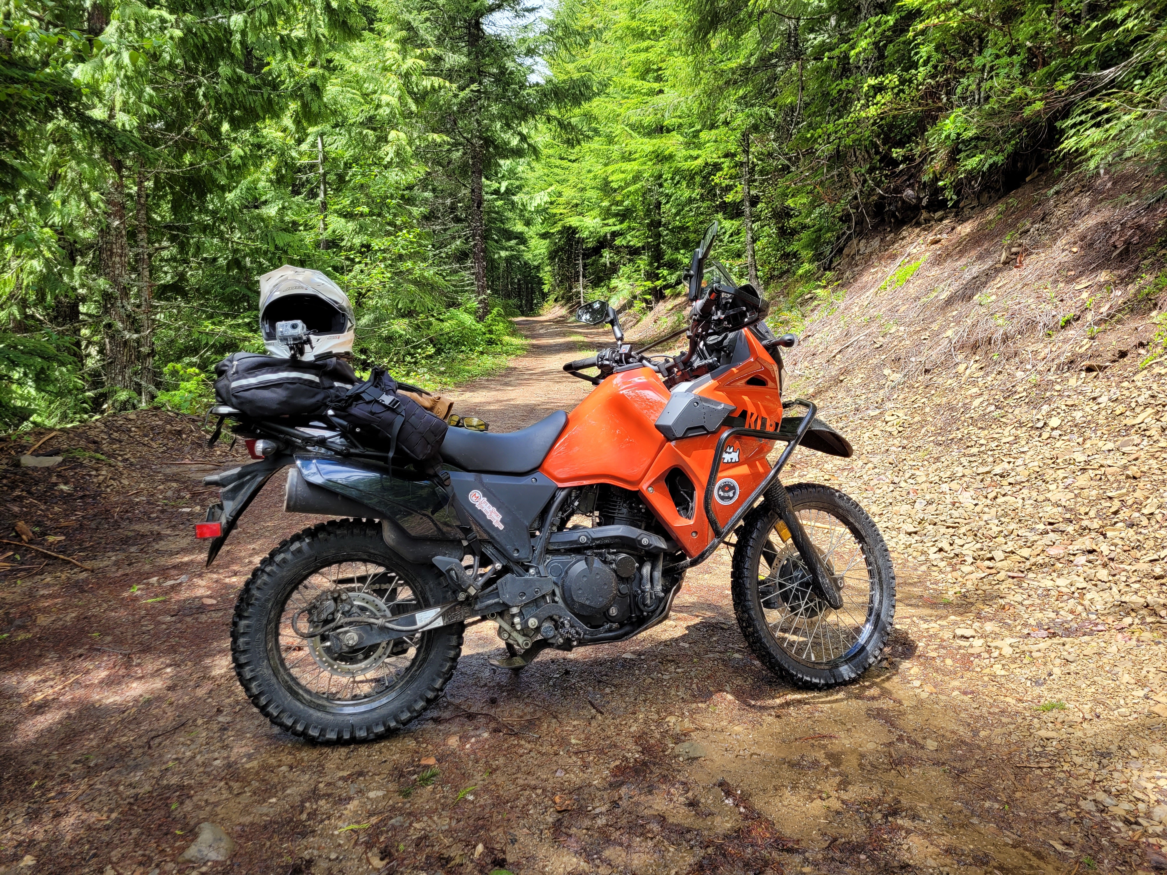
In this video I go through my mods (updated from the older vid) and also show the bag setup.
MIRRORS: Doubletake
https://www.doubletakemirror.com/
CRASH BARS: DirtRacks
https://www.dirtracks.com/collections/klr650
BASH PLATE: Enduro Engineering
https://www.amazon.com/gp/product/B07GL6YPRZ/ref=ppx_yo_dt_b_search_asin_title?ie=UTF8&psc=1
BASH PLATE EXTENDER: Enduro Engineering
https://www.amazon.com/gp/product/B07HF4K3ZP/ref=ppx_yo_dt_b_search_asin_title?ie=UTF8&psc=1
PHONE HOLDER:
https://www.amazon.com/gp/product/B085DMV7XD/ref=ppx_yo_dt_b_search_asin_title?ie=UTF8&psc=1
TRUNK: Chase Harper
...
I get asked regularly how I plan my routes and which apps I use.
PLANNING
I research using Google Maps and the USDA Forest Road Website (https://www.fs.usda.gov/ivm/)
Once I feel like I have a plan, I create my routes using (MyMaps.Google.com) which allows adding points and connecting them.
I then export the created map as KML
APPS
I mainly use Maps.Me as it supports importing the KML created. Be aware the actual map it uses is often slightly different from what Google has.
I also use the USDA Forest Map app as a backup. It's a good way to know how long and how rough forest roads are , but ALSO if it's open all winter of not (Snow notwithstanding) I've had a couple rides that Google allowed me to map, but turned out to be Closed (no longer used/accessible) so I'm starting to reference the forest app and website more to double check.
The third App is Avenza. For me it's only used with Geo Referenced PDFs. The main one for me is the Capital Forest.